Is Canada bigger than the USA?
About the same. Canada is about the same size as the United States.
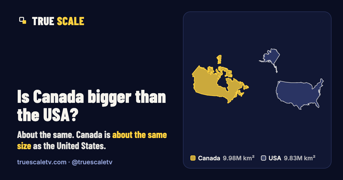
9.98 million km² (3.86 million mi²) against 9.83 million km² (3.8 million mi²).
- Canada 9.98 million km² · 3.86 million mi²
- USA 9.83 million km² · 3.8 million mi²
Same scale, real shapes: each is drawn in an equal-area projection centred on itself. The bar is 2,500 km (1,550 miles). Small islands of Canada and the USA are left out of the drawing; the figures include them.
The numbers
| Canada | USA | |
|---|---|---|
| Official area | 9,984,670 km² | 9,833,517 km² |
| Square miles | 3.86 million mi² | 3.8 million mi² |
| Rank by area | #2 of 235 | #3 of 235 |
| Main landmass centred at | 59° N | 40° N |
| Mercator inflation | 5.1× | 2.3× |
| Figure from | UN (2024) | UN (2024) |
Canada is 1.02 times the area of the USA: a difference of 1.5%, which is within the 2% we call “about the same size”. Mercator inflation is how much bigger the whole outline is drawn on a web map than its real area.
Why Canada looks bigger on maps than it is
Most web maps use the Mercator projection, which keeps shapes but inflates area by 1/cos² of the latitude. The main landmass of Canada is centred near 59° N, where everything is drawn about 3.7× too big; the United States is centred near 40° N, where the factor is about 1.7×. Averaged over the whole outlines, Canada is inflated about 5.1× and the USA about 2.3×.
So on a web map Canada looks about 2.3 times as big as the United States, measured on the same outlines. In reality, Canada is about the same size as the United States.
How big is the difference?
The difference is about 151,000 km² (58,400 mi²), roughly the area of Bangladesh. That is less than 2% of either, so we call them about the same size; small differences in how lakes, coasts and borders are measured could change which one comes out ahead.
Good to know
- Canada's total includes 891,163 km² of fresh water (Statistics Canada). On dry land alone it is 9,093,507 km².
- The USA's total (9,833,517 km², UN and CIA) includes coastal and territorial water. Without it the figure is about 9.5 million km² (Britannica), which is why sources disagree on whether the USA or China is bigger.
- Both figures are total areas, including lakes and rivers.
Questions
Is Canada bigger than the USA?
About the same. Canada is about the same size as the United States: 9.98 million km² (3.86 million mi²) against 9.83 million km² (3.8 million mi²).
Why does Canada look so big on maps?
Because it is far from the equator. Most web maps use the Mercator projection, which inflates area away from the equator. Canada is centred near 59° N, where areas are drawn about 3.7× too big. On a web map Canada looks about 2.3 times as big as the United States. In reality, Canada is about the same size as the United States.